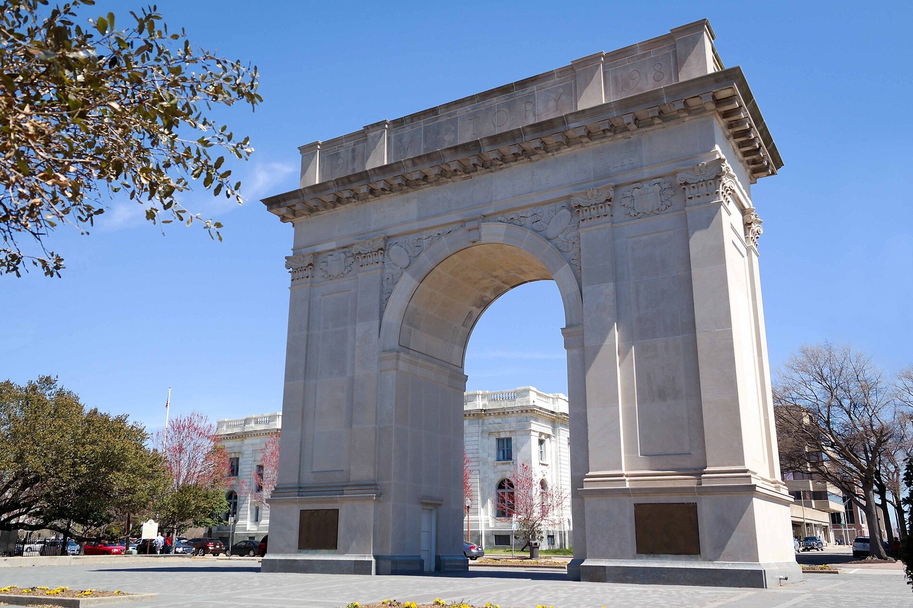
Newport News source photograph

Outdoors

Boating and kayaking near Newport News

Lakes, reservoirs and rivers near Newport News for boating, kayaking, canoeing and paddleboarding.

21places to boat and paddle
24 mito the closest
1within 30 miles
April–Octoberbest months

Good to know: Life jackets are required for children on most waters, and many lakes require an invasive-species inspection or a launch fee.

Closest picks

1

Chesapeake Bay Virginia National Estuarine Research Reserve

24 mi northwest · National Oceanic and Atmospheric Administration

The Chesapeake Bay (VA) National Estuarine Research Reserve features four components that are all within the York River basin--Goodwin Islands, Catlett Islands, Taskinas Creek and Sweet Hall Marsh.
2

Eastern Shore of Virginia National Wildlife Refuge

31 mi east · Fish and Wildlife Service

Lying at the tip of the Delmarva Peninsula, the Eastern Shore of Virginia National Wildlife Refuge serves as one of the country's most valuable stopovers for migratory birds.

3

Great Dismal Swamp National Wildlife Refuge

32 mi south · Fish and Wildlife Service

The Great Dismal Swamp National Wildlife Refuge is the largest intact remnant of a vast forested wetland that once covered more than one million acres of southeastern Virginia and northeastern North Carolina.

Map of all 21 places

Map of 21 places loads as you scroll.

Within 30 miles (1)

24 mi northwest · National Oceanic and Atmospheric Administration

Chesapeake Bay Virginia National Estuarine Research Reserve

The Chesapeake Bay (VA) National Estuarine Research Reserve features four components that are all within the York River basin--Goodwin Islands, Catlett Islands, Taskinas Creek and Sweet Hall Marsh.

  • Biking
  • Fishing
  • Hiking
  • History
  • Horseback riding
  • Hunting
  • Observation Site
  • Paddling

30 to 75 miles (7)

31 mi east · Fish and Wildlife Service

Eastern Shore of Virginia National Wildlife Refuge

Lying at the tip of the Delmarva Peninsula, the Eastern Shore of Virginia National Wildlife Refuge serves as one of the country's most valuable stopovers for migratory birds.

  • Biking
  • Birding
  • Boating
  • Fishing
  • Hiking
  • Hunting
  • Motor Boat
  • Nature education

32 mi south · Fish and Wildlife Service

Great Dismal Swamp National Wildlife Refuge

The Great Dismal Swamp National Wildlife Refuge is the largest intact remnant of a vast forested wetland that once covered more than one million acres of southeastern Virginia and northeastern North Carolina.

  • Birding
  • Boating
  • Camping
  • Fishing
  • Hiking
  • Hunting
  • Motor Boat
  • Nature education

36 mi west · Fish and Wildlife Service

James River National Wildlife Refuge

James River National Wildlife Refuge was established in 1991 to conserve fish and wildlife which are listed as endangered or threatened species, and to protect bald eagles.

  • Boating
  • Educational Programs
  • Fishing
  • Hunting
  • Nature education
  • Paddling
  • Photography
  • Ranger programs

44 mi southeast · Fish and Wildlife Service

Back Bay National Wildlife Refuge

Back Bay National Wildlife Refuge was established in 1938 to protect and provide habitat for migratory and wintering waterfowl, or ducks, geese and swans.

  • Beach
  • Biking
  • Birding
  • Educational Programs
  • Fishing
  • Hiking
  • Hunting
  • Nature education

48 mi southeast · Fish and Wildlife Service

Mackay Island National Wildlife Refuge

Congress established the Mackay Island National Wildlife Refuge on December 30, 1960, by the authority of the Migratory Bird Conservation Act of 1929.

  • Archery
  • Biking
  • Birding
  • Boating
  • Educational Programs
  • Fishing
  • Hiking
  • Hunting

56 mi southeast · Fish and Wildlife Service

Currituck National Wildlife Refuge

Currituck NWR, located on the northern end of North Carolina's Outer Banks, was established in 1984 to preserve and protect the coastal barrier island ecosystem.

  • Biking
  • Birding
  • Boating
  • Fishing
  • Hiking
  • Hunting
  • Motor Boat
  • Non-Motorized Boating

68 mi north · Fish and Wildlife Service

Rappahannock River Valley National Wildlife Refuge

Rappahannock River Valley National Wildlife Refuge was established in 1996 to conserve and protect fish and wildlife resources, including endangered and threatened species and wetlands.

  • Educational Programs
  • Fishing
  • Hiking
  • Hunting
  • Non-Motorized Boating
  • Photography
  • Wildlife viewing

75 miles and farther (13)

78 mi south · Fish and Wildlife Service

Roanoke River National Wildlife Refuge

Roanoke River NWR was established in 1989 to protect and enhance wooded wetlands consisting of bottomland hardwoods and swamps with high waterfowl value along the Roanoke River.

  • Archery
  • Birding
  • Boating
  • Educational Programs
  • Fishing
  • Hiking
  • Hunting
  • Motor Boat

80 mi north · National Park Service · Campground

George Washington Birthplace National Monument Picnic Pavilion

The Popes Creek Picnic Area Pavilion is located within George Washington Birthplace National Monument. The surrounding picnic grounds were built by the Civilian Conservation Corps in the 1930's.

  • Biking
  • Boating
  • Camping
  • Fishing
  • Hiking
  • History
  • Hotel/Lodge/Resort Privately Owned
  • Ranger programs

82 mi south · Fish and Wildlife Service

Pocosin Lakes National Wildlife Refuge

The 110,000-acre Pocosin Lakes National Wildlife Refuge conserves a rare type of wetland habitat, known as "pocosin," derived from a Native American word meaning "swamp on a hill." In 1963, Pungo NWR was established for the protection of…

  • Archery
  • Biking
  • Birding
  • Boating
  • Educational Programs
  • Fishing
  • Hiking
  • Hunting

85 mi north · Commander, Navy Installation Command (CNIC) · Campground

Pax River Hog Point Campgrounds

Visitors eligible for reservations at this location are limited to Active Duty, Reservists, Retired Military, Unremarried Widow, Veterans and Department of Defense employees.

  • Biking
  • Boating
  • Camping
  • Canoeing
  • Crabbing
  • Fishing
  • Golf
  • Hunting

85 mi north · Commander, Navy Installation Command (CNIC) · Campground

Pax River Paradise Grove Campgrounds

Visitors eligible for reservations at this location are limited to Active Duty, Reservists, Retired Military, Unremarried Widow, Veterans and Department of Defense employees.

  • Camping
  • Canoeing
  • Crabbing
  • Fishing
  • Golf
  • Hunting
  • Kayaking
  • Paddle Boating

86 mi northeast · Fish and Wildlife Service

Chincoteague National Wildlife Refuge

Located on the Indigenous homelands of the Pocomoke and Occohannock people, Chincoteague National Wildlife Refuge protects beach, dune, marsh, and maritime forest habitats.

  • Beach
  • Biking
  • Birding
  • Boating
  • Fishing
  • Hiking
  • History
  • Horseback riding

91 mi southeast · Fish and Wildlife Service

Alligator River National Wildlife Refuge

Alligator River National Wildlife Refuge is located on the Albemarle Peninsula in eastern North Carolina. The refuge was established in 1984 to protect the rare pocosin wetlands and their associated wildlife.

  • Biking
  • Birding
  • Boating
  • Educational Programs
  • Fishing
  • Hiking
  • Horseback riding
  • Hunting

101 mi northeast · National Park Service · Campground

Assateague Island National Seashore Campground

Assateague Island National Seashore is a 37-mile long barrier island on the Atlantic Coast of Maryland and Virginia.

  • Beach
  • Biking
  • Birding
  • Camping
  • Canoeing
  • Clam Digging
  • Crabbing
  • Fishing

104 mi southeast · National Park Service · Campground

Oregon Inlet Campground

Oregon Inlet Campground is the northernmost campground on Cape Hatteras National Seashore.

  • Boating
  • Camping

105 mi west · US Army Corps of Engineers · Campground

North Bend Park

North Bend Park is located on John H. Kerr Reservoir, a 50,000-acre lake that extends 39 miles up the wooded, cove-studded shoreline of the Roanoke River in Virginia and North Carolina.

  • Amphitheater
  • Biking
  • Birding
  • Boating
  • Camping
  • Disc Golf
  • Evening Programs
  • Fishing

110 mi west · US Army Corps of Engineers · Campground

Rudds Creek Rec. Area

Rudds Creek Park is located on John H. Kerr Reservoir, a 50,000-acre lake that extends 39 miles up the wooded, cove-studded shoreline of the Roanoke River in Virginia and North Carolina.

  • Amphitheater
  • Boating
  • Camping
  • Evening Programs
  • Fishing
  • Hiking
  • Hunting
  • Nature education

117 mi west · US Army Corps of Engineers · Campground

Longwood Park

Longwood Park is located on John H. Kerr Reservoir, a 50,000-acre lake that extends 39 miles up the wooded, cove-studded shoreline of the Roanoke River in Virginia and North Carolina.

  • Boating
  • Camping
  • Canoeing
  • Fishing
  • Picnicking
  • Swimming
  • Wildlife viewing

120 mi west · US Army Corps of Engineers · Campground

Buffalo Park

Buffalo Park is a small day use and campground park, located on John H. Kerr Reservoir. The campground is open May 1 - September 30. The Day Use Park is open year-around.

  • Birding
  • Boating
  • Camping
  • Canoeing
  • Fishing
  • Swimming
  • Water Access

Distances are straight-line miles from the center of Newport News. Listings come from Recreation.gov’s federal recreation database; check each official page for hours, fees, fire restrictions and closures before you go.

Get outside around Newport News

Around Newport News

ID Pandion haliaetus -- Osprey, Newport News
ID Pandion haliaetus -- OspreyTony Alter from Newport News, USA · CC BY 2.0
Whittaker Memorial Hospital (Front), Newport News
Whittaker Memorial Hospital (Front)Joseph Sullivan · CC BY-SA 3.0
I think it did pretty good for a phone camera, Newport News
IPhone PhotoTony Alter from Newport News, USA · CC BY 2.0

More outdoors near Newport News

Questions

Where is the closest place for boating & paddling near Newport News?

Chesapeake Bay Virginia National Estuarine Research Reserve (National Oceanic and Atmospheric Administration), about 24 miles northwest of Newport News as the crow flies. Next are Eastern Shore of Virginia National Wildlife Refuge (31 mi) and Great Dismal Swamp National Wildlife Refuge (32 mi).

When is the best time for boating & paddling near Newport News?

Based on Newport News’s average highs, April–October. Conditions at higher elevations can be much cooler.

Who manages these places?

Federal agencies including Fish and Wildlife Service, US Army Corps of Engineers, National Park Service. Each listing links to its official page for hours, fees, closures and current conditions.

Newport News AI

Your Newport News local guide
Hey there!

I'm Newport News AI. Ask about neighborhood food, independent shops, local history or planning a visit.

AI recommendations may be inaccurate. Verify hours and prices. Questions are processed by Cloudflare. Privacy